Explore

Archaeological 3D GIS
Nicolò Dell’Unto and Giacomo Landeschi
2022
0 Ungluers have
Faved this Work
Login to Fave
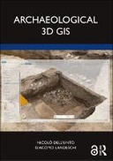
Archaeological 3D GIS provides archaeologists with a guide to explore and understand the unprecedented opportunities for collecting, visualising, and analysing archaeological datasets in three dimensions. With platforms allowing archaeologists to link, query, and analyse in a virtual, georeferenced space information collected by different specialists, the book highlights how it is possible to re-think aspects of theory and practice which relate to GIS. It explores which questions can be addressed in such a new environment and how they are going to impact the way we interpret the past. By using material from several international case studies such as Pompeii, Çatalhöyük, as well as prehistoric and protohistoric sites in Southern Scandinavia, this book discusses the use of the third dimension in support of archaeological practice. This book will be essential for researchers and scholars who focus on archaeology and spatial analysis, and is designed and structured to serve as a textbook for GIS and digital archaeology courses. The Open Access version of this book, available at www.taylorfrancis.com, has been made available under a Creative Commons Attribution-Non Commercial-No Derivatives 4.0 license.
This book is included in DOAB.
Why read this book? Have your say.
You must be logged in to comment.
Rights Information
Are you the author or publisher of this work? If so, you can claim it as yours by registering as an Unglue.it rights holder.Downloads
This work has been downloaded 32 times via unglue.it ebook links.
- 32 - pdf (CC BY-NC-ND) at OAPEN Library.
Keywords
- Agisoft Photoscan
- Anthropic Elements
- Ascii File
- Caecilius Iucundus
- Current Data Models
- Derive Digital Elevation Models
- ESRI ArcGIS
- ESRI Arcview
- Generating Risk Maps
- GIS Platform
- GIS Software
- GIS Software Package
- Global Navigation Satellite Systems
- Graphic Documentation
- Map Algebra Operations
- point clouds
- Polygon Shapefile
- Pompeian House
- Raster Dataset
- Raster DEMs
- RTK Gps
- thema EDItEUR::N History and Archaeology::NK Archaeology::NKL Landscape archaeology
- thema EDItEUR::N History and Archaeology::NK Archaeology::NKX Archaeological science, methodology and techniques
- Trowel’s Edge
- User's Eye Movement
- VR Environment
Links
DOI: 10.4324/9781003034131Editions

