Explore

Advanced Geoscience Remote Sensing
0 Ungluers have
Faved this Work
Login to Fave
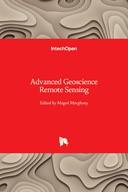
Nowadays, advanced remote sensing technology plays tremendous roles to build a quantitative and comprehensive understanding of how the Earth system operates. The advanced remote sensing technology is also used widely to monitor and survey the natural disasters and man-made pollution. Besides, telecommunication is considered as precise advanced remote sensing technology tool. Indeed precise usages of remote sensing and telecommunication without a comprehensive understanding of mathematics and physics. This book has three parts (i) microwave remote sensing applications, (ii) nuclear, geophysics and telecommunication; and (iii) environment remote sensing investigations.
This book is included in DOAB.
Why read this book? Have your say.
You must be logged in to comment.
Rights Information
Are you the author or publisher of this work? If so, you can claim it as yours by registering as an Unglue.it rights holder.Downloads
This work has been downloaded 40 times via unglue.it ebook links.
- 40 - pdf (CC BY) at mts.intechopen.com.
Keywords
- Geographical information systems (GIS) & remote sensing
- Geography
Links
DOI: 10.5772/57046Editions

