Explore

Integrated Use of Space, Geophysical and Hyperspectral Technologies Intended for Monitoring Water Leakages in Water Supply Networks
0 Ungluers have
Faved this Work
Login to Fave
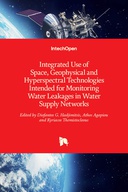
Remote sensing has been used for water management purposes over the years. This book describes the combination of satellite imagery, in-situ spectroradiometric data and radar techniques for the identification of water leakages in the water supply network in both rural and urban areas in Cyprus. This book presents a holistic approach combining new technologies for a complete system of water distribution network leakage detection management, by combining Global Navigation Satellite Systems (GNSS), Geographical Information Systems (GIS), Satellite Remote Sensing techniques as well Geophysical surveys such as ground penetrating radar (GPR), Unmanned Aerial Vehicles (UAV) and spectro-radiometric measurements, which can be used to effectively identify and monitor water leakages.
This book is included in DOAB.
Why read this book? Have your say.
You must be logged in to comment.
Rights Information
Are you the author or publisher of this work? If so, you can claim it as yours by registering as an Unglue.it rights holder.Downloads
This work has been downloaded 42 times via unglue.it ebook links.
- 42 - pdf (CC BY) at mts.intechopen.com.
Keywords
- Communications engineering / telecommunications
- Electronics & communications engineering
- Hydraulic engineering
- Mobile phone technology
- Technology, engineering, agriculture
- Telephone technology
Links
DOI: 10.5772/58836Editions

