Explore

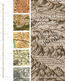
Kartografski zakladi slovenskega ozemlja = Cartographic Treasures Of Slovenian Territory
0 Ungluers have
Faved this Work
Login to Fave
The book presents a wealth of historical cartographic representations of Slovenian territory. It is divided into two main parts. The first or the text part briefly presents the history of European cartography up to the end of the nineteenth century, maps of the Slovenian territory up to the early twentieth century and maps as cultural heritage. In the second or cartographic part, in turn, features important historical maps of the Slovenian territory presented in chronological order. The format of the book enables an excellent presentation of the presented maps. The maps presented date from the mid-sixteenth century, when the first independent maps of present-day Slovenia were produced, to the beginning of the twentieth century, when cartography developed into a modern discipline. The aim of this book is to present the extensive Slovenian cartographic heritage.
This book is included in DOAB.
Why read this book? Have your say.
You must be logged in to comment.
Rights Information
Are you the author or publisher of this work? If so, you can claim it as yours by registering as an Unglue.it rights holder.Downloads
This work has been downloaded 68 times via unglue.it ebook links.
- 68 - pdf (CC BY-NC-ND) at Unglue.it.
Keywords
- Cartography
- Eastern Europe
- Europe
- geografija
- Geographical Qualifiers
- Geography
- Historical geography
- Historical maps & atlases
- History
- History: specific events & topics
- Humanities
- kartografija
- Maps
- Slovenia
- Slovenija
- Southeast Europe
- thema EDItEUR::1 Place qualifiers::1D Europe::1DX Southeast Europe::1DXV Slovenia
- thema EDItEUR::N History and Archaeology::NH History::NHT History: specific events and topics::NHTP Historical geography::NHTP1 Historical maps and atlases
- Yugoslavia & former Yugoslavia
- zemljevidi
- zgodovina
Links
DOI: 10.3986/9789610504276Editions

