
Explore
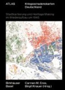
Atlas Kriegsschadenskarten Deutschland
0 Ungluers have
Faved this Work


Login to Fave
For the first time, the Atlas Kriegsschadenskarten (Atlas of War Damage Maps) prepares an important source inventory for urban research and presents maps of Nuremberg, Hamburg, Hanover, Freiburg, Leipzig, and Essen from the 1940s and 1950s in large-format illustrations. Introductory essays are devoted to the development of war damage recording and discuss the significance of map documents for reconstruction and heritage processes.
This book is included in DOAB.
Rights Information
Are you the author or publisher of this work? If so, you can claim it as yours by registering as an Unglue.it rights holder.Downloads
This work has been downloaded 114 times via unglue.it ebook links.
- 114 - pdf (CC BY-NC-ND) at OAPEN Library.
Links
DOI: 10.1515/9783035625011Editions